Sinkholes and Why They Matter
/Sinkholes can be dangerous in many ways.
MEASURING SINKHOLE POTENTIAL RISK
Karst is defined as “a terrain, generally underlain by limestone, in which the topography is chiefly formed by the dissolving of rock, and which is commonly characterized by Karren, closed depressions, subterranean drainage, and caves” by the Geological Survey Water-Supply Paper 1899. Each component listed above (Karren, closed depressions, subterranean drainage, and caves) are considered karst features, but most importantly, sinkholes are considered karst features.
Sinkholes can be dangerous in many ways. They can cause damage to the foundation of a building, they serve as conduits for surficial contaminants to reach groundwater, and they can cause damage to buried services like water lines and electrical conduits according to Conserve Energy Future. Knowing the risk of sinkhole formation is key to minimizing possible damages.
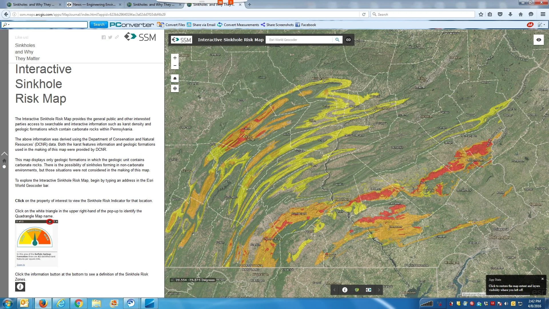
Since the amount of karst features in an area can be related to the occurrence of sinkholes, an interactive sinkhole risk map was created using the density of karst features within a geologic formation.
Interactive Sinkhole Risk Map
The Interactive Sinkhole Risk Map provides access to searchable and interactive information such as karst density and geologic formations which contain carbonate rocks within Pennsylvania. The map displays only geologic formations in which the geologic unit contains carbonate rocks. There is the possibility of sinkholes forming in non-carbonate environments, but those situations were not considered in the making of this map. Explore the Interactive Sinkhole Risk Map to view the Sinkhole Risk for any location.
If a sinkhole evaluation of a location is desired, SSM Group, Inc. has multiple professionals on staff with years of experience in sinkhole risk evaluations. Feel free to contact SSM Group, Inc. to learn more.


